The main content of this week’s work was carried out in Houdini. Before that, I tried to use WorldCreator and WorldMechine to generate game terrain. Through comparison, it is found that Houdini’s degree of freedom will be higher, and WorldCreator’s production will be faster and more convenient. Because of my special terrain, the requirements for the terrain are relatively high. So I chose to use Houdini to generate terrain.
Process
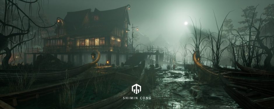
First, let’s take a look at the landscape concept map.
The overall appearance of this terrain looks like a fish. This is also an important reason why I chose to use Houdini to generate maps.
Before introducing the process, I will record some key landscape nodes.
- Heightfield_This is the first step in creating the terrain. At the same time we can set the terrain size.
- HeightfieldNoise_Creating terrain noise, where the second input port is the input mask. The red ones represent the scope of influence.
- HeightfieldDrawmask_Manually select the mask range
- HeightfieldPaint_Manually draw the mask range
- HeightfieldDistort_Generate distortion, which can be used to make terrain details
- HeightfieldLayer_Highly mixed
- Heightfieldpattern_Pattern generation height
- Heightfieldmaskbyobject_Project the object onto the plane, and then generate a mask
- Heightfieldmaskblur_This node can blur the mask
- HeightfieldProject_Projecting objects onto the terrain.
- HeightfieldClearmask_Clean up the mask, if it is not cleaned, it will affect the production of the subsequent mask.
- Heightfieldslump_Generate terrain erosion
- Heightfielderode_Calculate the erosion results of the terrain and generate complex terrain.
- HeightfieldCopylayer_Generate a new layer, which can be used to extract the mask
- HeightfieldTerrace_Generate terraces
- Heightfieldremap_This node can be used to remap the height, and it can also be used to change the contrast of the mask
- HeightFieldScatter_Scatter points in the corresponding mask
- HeightfieldClip_Redefine the altitude range of the terrain
After introducing the node, I can briefly explain my production ideas.
First, I used the spline curve to draw the shape of the fish and mapped it into a mask. After getting the mask, use the Heightfieldpattern node to extrude the terrain downward.
Then, using the same method to make deeper terrain.
Other details of the height is the same operation.
After getting the rough terrain of the landscape, I started to increase the details step by step. As shown in the picture, I first added some chaos to the terrain.
Then I mapped a fish-land model in the middle of the map, through the HeightfieldProject node.
In addition, I also added some noise, which makes the terrain change up and down.
After finishing all the detailed modulations, I used the HeightfieldErode node to calculate the complex terrain.
The last stage is to define the range of different materials such as rocks, grass, soil and so on through the mask. In this building, I used different colors to show these areas. The purpose of this process is to facilitate the automatic assignment of terrain materials and plants in Unreal.
The last production content this week is HDA editing. We can expose some of the parameters that need to be adjusted in the HDA menu.
That’s all the content of this week. By studying the production of this terrain, I have basically mastered the flow of Houdini terrain production.